In the first part of this reportage we presented you with an overview of the Scottish transport company, Hebrides Haulage. This company operates in a difficult market, providing deliveries of basic goods to people living in one of Europe most remote places. So how it is to be a driver in a firm, that sends its lorries to places that are served by almost nobody else? In this part of our reportage we will acompany a driver heading for islands of Uists and Benbecula.
Let’s go!
We have a luxury to come to work later than others. The company is slowly waking up for a day’s work: other drivers took the lorries out of the warehouse and unloaded those few items that arrived from the Islands. The van for Bute has already left, other drivers are sipping their coffees and await their route plans.
Our 18-tonne DAF CF, the newest member of the fleet, was loaded on a prevous evening. Of course there will be no harm in checking once again if the load is secured prroperly. The boss brings two small parcels that were delivered by courier this morning, and we are ready to go.
We collect a small brown box from the reception – this is our mobile office. The box contains fuel cards, ferry timetable, map of the islands and list of useful phone numbers. There are also boarding cards for the ferry and POD documents, sorted in three files marked “North Uist”, “Benbecula” and “South Uist”. There is still time to fill ouf flask with hot coffee and to mount our camera on the windscreen so we can shoot some movies from the road and finally we climb behind the wheel.
Hebrides Haulage depot is located in the Western part of Glasgow, at the northern bank of the river Clyde, so in no time we reach Great Western Road that, as the name suggest, is a main route for those, who want to live the city in that direction. On the city limits we pass Whisky Distillery and Erskine Bridge – the last crossing over the river before it spreads in wide firth of Clyde. But there is no time to enjoy the views, as soon we reach a big roundabout, which indicates that we have reached Dumbarton. We pass the town on the side and after crossing another two roundabouts, we find ourselves on the dual carriage way. This short stretch is the last bit of the road of such high standard on our route, as after just few more minutes it ends with another big roundabout, after which the single carriageway road will lead us on the banks of Loch Lomond. Yes, Glasgow is located in such beautiful place, that just after 30 minutes we leave civilisation to dive into Loch Lomond and The Trossachs national park. Luckily, on Wednesday morning in October traffic is light, but amazing views suggest that this is not the case during tourist season. And it’s true: during the summer, A82 is filled up the horizon with campers, caravans and coaches full of tourists from all over the world. It should not bother a lorry driver for the first half of the 40 km long lochside road, but the situation changes dramatically when our road branches to the right in Tarbert. (Click links to view dashcam movies from described parts of the route).
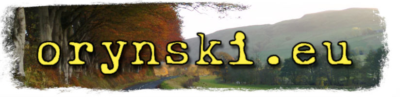
Here, the road narrows to the standard that not many people would expect from the national route in Western European country. The lanes can barely accommodate the width of the lorry and numerous bridges, stone walls and protruding rocks and trees often narrow it down even further. It is nothing unusual here that to pass each other, truckers have to fold their mirrors.
From now it becomes very easy to spot drivers who are not regulars on that route. While scared coach drivers slowly negotiate each bend, strongly grasping the wheel in their sweated hands, drivers of speeding timber lorries greet each other with a friendly wave. But to be fair on those coach drivers it is not only about skills, and perhaps even more about knowledge. Despite the fact that for the first-timer it might look equqally narrow everywhere, this narrow strip of tarmac widens from time to time by some extra few inches. By adjusting one’s speed to the speed of the oncoming vehicle, you can ensure that passing each other will take place in that slightly wider stretch of the road. It is worth to know some other tricks – for example to safely pass oncoming car on the left bend, the lorry driver might go to the right half of the street, then straighten his trajectory and get closer to the left, leaving more place for the oncoming driver. But to some car drivers the view of the oncoming truck taking ¾ of the road might be a real scare. Therefore wheneve possible it is advisable to avoid passing each other on the narrow bend. After dark this can come easier if you decide to switch your headlights for the split-second – that way you can see if there is anyone coming towards you behind the bend. But sometimes it is simply impossible to avoid meeting other vehicle in the narrow bits, and then it is necessary for one vehicle to stop and give way to another – even if only one of them is a truck.
But even the longest lake has to end some time. So even those, who go the lochside bit in the slowest pace finally reach the place when road becomes wider again. From there the drive will be a pure relax, even for them.
Through the most beautiful places in Scotland
Loch Lomond, located just outside Glasgow, is the first attraction of the many scattered along A82, thus making it the most popular route for the tourist willing to see famous (although slightly overrated) Loch Ness. Therefore we have to get used to the view of the cars parked on the grassy shoulders, surrounded by tourists with their cameras photographing the stunning scenery. I can fully understand that – one will never get bored of those views: I am a regular on that route for more than a decade and still can’t get enough.
And so, after the lake ends, we pass the roadside Drovers Inn and the road starts to climb up to lead us to a small village on Crianlarich, located at the crossroads. Here we take left and soon we arrive to another village – Tyndrum. Here if we go left again, we can go to Oban, but this time we choose the right branch, winding up another hill. From now on, we will cross almost unpopulated arena, with the exception of couple of farms and Bridge of Orchy, a small settlement consisting of a hotel, couple of houses and a train station. Not far from there, after crossing the river on a slightly bigger bridge, the road starts to climb up again. Aprrox 2/3 way up there is a big tarmac parking space that during toursit season is full of tourist cars and coaches, served by a burger van and souvenir stand. But at this time of the year the car park is usually empty, and the trucks that park there for the night are approached by tamed roe-deers. The bravest of them are coming to your window, begging for food, and I can say for sure that the roe deers are NOT vegetarian: once one of them have stolen my pate sandwich.
But for us there is not time for a break yet. We just started our journey, so we continue to climb up until we reach the summit, from where a beautiful panorama opens up ahead of us. Closer to us there are numerous ponds, and across the plateu one can see snowy peaks of the mountains. This is the gate to the Highlands, famous Rannoch Moors. Few miles down that road there will be another climb and then another amazing views open up. This time the landscape is even more spectacular, as directly ahead of us there are majestic mountains surrounding Glen Coe.
Around here there are long time no seen signs of civlilsation. On the right, surrounded by some trees, hotel in the middle of nothing. On the left – ski centre, as this region is unique for it’s climate and snow stays here longer than in other places (making the landscape even more beautiful)
Here we can also turn left into one of the most stunning roads in Scotland – narrow, tarmac stripe leading into Glen Etive. It is the road that James Bond drives in Skyfall to a Scottish land of his childhood memories.
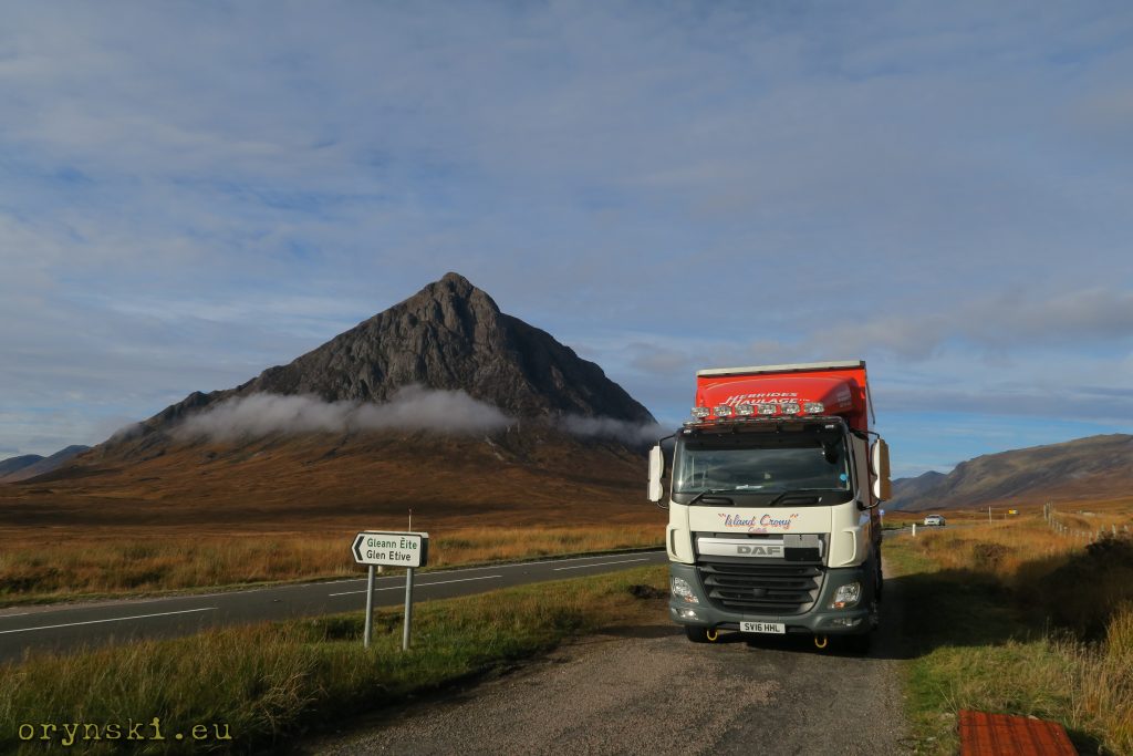
But we ar not going to follow his steps and we continue along A82 instead. The mountains seem to be leaning over our heads and the wide valley narrows down to a small stream and a narrow road carved in the rock pararel to it. Just after that narrow opening a proper Glen Coe valley opens up. The road is traverssing down under the careful eyes of Three Sisters towering over it from the left. The views are stunning, mountainous atmosphere amazing, but this is Scotland, so who said, that we cannot be at the seaside as well? Just 15 minutes later we are in the village of Glencoe, located over Loch Leven which is nothing else, but a Norwegian style long sea bay curving into the mountains.
From now on, we are back to civilisastion. The road character will be different as far as to Fort William. For some time we are following traces of the old railway line (the only remainder is a lonely semaphore located next to the church on the left), soon after we will cross the bay using a steel lattice bridge and continue our journey along the bay on it’s other side. Soon the road turns right to follow it’s second branch, Loch Lihne. Here those, who are heading for Ardnamurchan penninsula, can use Corran ferry to get across the water. But we are staying on the right bank, and soon find ourselves at the outskirts of Fort William. This town is the biggest locality in the area and a leading centre of mountain tourism in the UK. Yeah, Ben Nevis, the highest peak of Britain, might be only 1345 metres high, but we have remember that Fort William is located at the sea level, so the height difference is approximately as big, as from highest quarter of Zakopane, Kuźnice (1010 m AMSL) to the one of the highest Polish peaks, Świnica (2301 m AMSL).
But there is no time for hiking. We have work to do, as Fort William is the last place on our route where we can fill up the tanks at reasobable price. But that takes only a while, and soon after we are continuing our journey along the ancient route of Scotland – the Great Glen
Few words on transport in Scotland.
A quick look on the map of Scotland reveils, that people settled mostly along the coast or the river banks. There was a simple reason: it was much easier to travel by the boat, than to hike through dangerous mountains or endless wetlands and bogs. This is why the islands, that for the moder men are lying at the outskirts of civilisation, for centuries it was the Hebrides that were one of the most important locations for the Scottish life. When St. Columba established his monastery in Iona, it was not supposed to be a hermitage – it was at the cross roads of important trade routes.
Gradually people started to venture deeper into the interior, but the boom for sheep wool associated with industrial revolution caused greedy landowners to evict people and change their farmland into the sheep grazing areas. The victims of those clearances were settled along the coast again, trying to make their living from fishing, or they had to choose migration. As a result, boats remained a major mean of transport for Scots until 20th century. Yeah, there were some railways build in 19th century, but it did brought many new settlers to the interior. Even today road or railroad building through Scottish highlands proves to be a engineering challenge – for example both road and railroad through Rannoch Moor requires an unique technology of “floating road”, in which the foundations are build on a kind of a raft floating in the bog.
But even when the infrastructure in the mainland improved greatly in the XIX century, getting to the islands was still a challenge. Especially to those, that does not have sheltered ports. Up to mid-20th century (and in some regions even up to 1980’s) the goods were delivered mostly by small steamers, so called Clyde Puffers. Those flat-bottomed vessels were designed to serve remote islands with no ports – their crews were awaiting high tides and then beaching them on the sand, so during lower tide they could be reached by road vehicles to be unloaded and then next high tide was taking already empty vessels back to the sea.
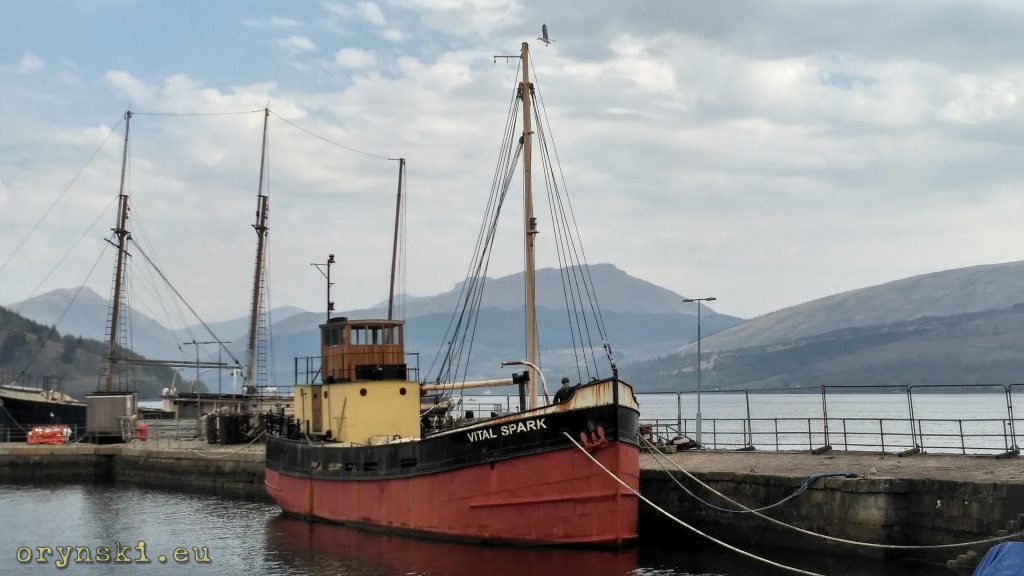
Although back breaking job, it was working well for the bulk loads or smalls, but the bigger loads were a challenge sometimes impossible without help of the Royal Navy, as you can see on the example of delivering whisky stills to Bowmore Distillery on Islay:
Another issue was a need to go long way. Scottish Western coastway, similar perhaps only to Norwegian Fjords, is longer than that of Spain and Portugal combined together. This is why as early as in XVII there were attempts to create some shortcuts: Forth and Clyde canal made it possible to transport cargo between East and West coast, and with Union Canal directly from Glasgow to Edinburgh. Caledonian Canal, smartly used natural landscape of Great Glen, made it possible even for quite a big vessels to go almost in straight line from Forth William to Inverness through Loch Lochy, Loch Oich and Loch Ness. Little known Crinan Canal crossed Knapdale, creating a shortcut from Glasgow to Hebrides allowing avoiding going around storm-battered Mull of Kintyre.
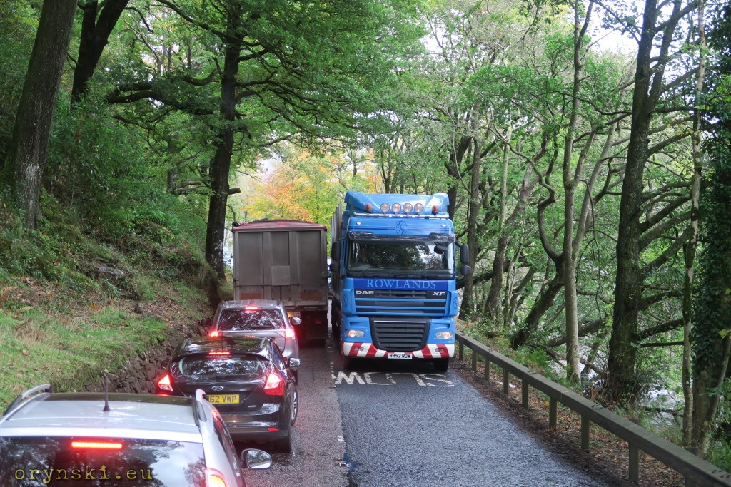
But it was only emergence of car ferries (in 60’s with a side loading lift, and then in 70’s all popular today ro-ro ferries) that finally ended Clyde Puffers time on the Western Coast. It has also completely transferred the ways of life on the islands, but it has also side-tracked some important marine towns such as Campbelltown. The size of the vessels, along with the improvement in road network, make also canals redundant, leaving them only for recreational use. Today bulk loads are often carried on the coastal ships, but other goods are transported mostly on the lorries. Hebrides Haulage, established in 1977, was one of the first companies that decided to take advantage of the new possibilities.
From sea to mountains and back in two hours
Crossing Great Glen by water can take up to three days, as crossing the canal involves numerours locks. By the car, or even a lorry, it’s nothing. After leaving Fort William we drive for a while towards Spean Bridge and then after narrow bridge turn left. Here the road climbs up and soon we can see a commando monument, remembering soldiers who were practicing in this area before being dropped into the warzone in Europe (including Polish cichociemni units). Soon the road goes down again, and leads on the bank of Loch Lochy. Some time later we cross the canal using the swing bridge and arrive at Invergarry. Inver – from gaelic Inbhir means mouth, and this is the place when river Garry reaches Loch Oich. And this is also the place, when we are to leave Great Glean after turning left towards Lochalsh.
This is one of the most beautiful bits of our route. The road starts just along the river to gradually submerge in the forrest full of birch trees. Later, it winds up a steep hill from where a beatiful panorama of Glen Garry can be seen.
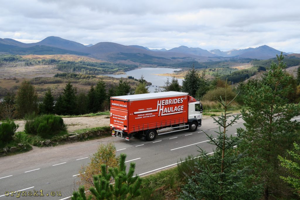
As most of the traffic – not only tourist traffic – continues along A82 towards Inverness, on this stretch of the road we can enjoy empty road even during the summer. There is also no way of getting loss, for the next hour or so there will be only two junctions: so called “longer blind street in the UK” – branching left into Glen Garry to reach, after 40 km, small settlement of Kinloch Hourn. The other one will be the place when we join the main road, where we can either turn left towards Skye, or right towards Loch Ness. Therefore we can put all of our worries away and just enjoy the relaxing drive, admiring amazing mountain landscape around the Loch Cluanie
Finally, after crossing yet another mountains, we will drive down to Shiel Bridge, where another road branches left to historic ferry crossing to skye (during the summer 80 years old turntable ferry still carries tourist cars across). From now on, we are going to drive along the coast – to be strict, along the bank of yet another long bay: Loch Duich. Somewhere around here our tachograph light will start flashing, so it’s the time to think about where to stop for our 45 minute break. And is there any better place than that with the view of one of the most known Scottish casles, Eilean Donan?
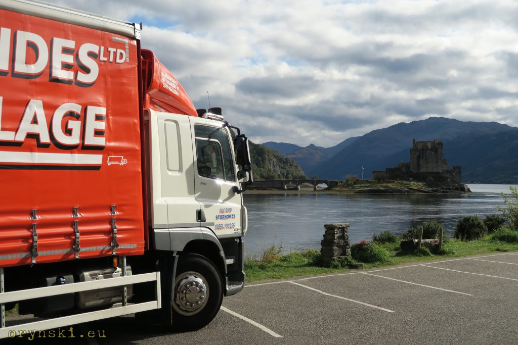
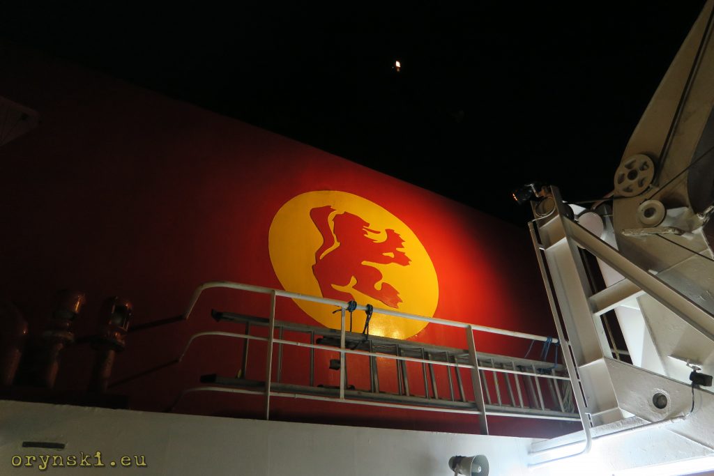
Orange lorry from Hebrides Haulage is nothing unusual in this corner of the woods, as here, in the village of Dornie, aforementioned third base of the company is located.
On the islands finally!
But 45 minutes has passed and it’s time to get back to work. Only few more villages and we will be crossing to the first island on our route. But it won’t be Isle of Skye, as many of those familiar with Scottish geography can think. Let’s take a closer look: before we cross to Skye on the huge arch bridge, a flat one will carry us over to a small island of Eilean Bàn, on which in the former lighthouse keeper’s house a small museum is located. Crossing that island is only a matter of seconds before we start climb Skye Bridge, from which there is an amazing view in every direction.
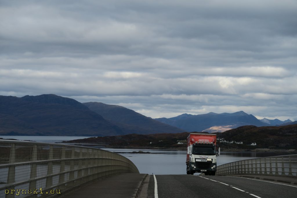
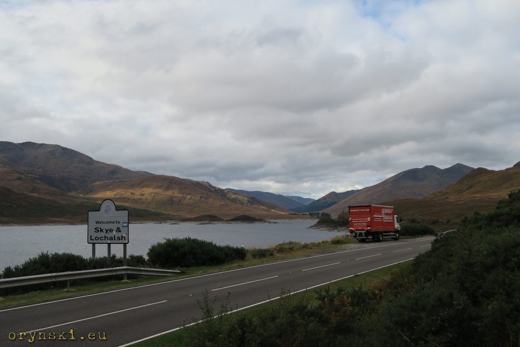
And so we finally reached Skye. But this is not the end of our journey, as ferries to Outer Hebrides leave from Uig, on the opposite end of the island. The northern part of Skye is separated from the Southern by a mountain range, that can be crossed by one and only road, leading roughly along it’s eastern coast. This is why the sign announcing road closures can be a little worrisome, but luckily the road is going to be closed only during the night, and even then every hour awaiting vehicles will be allowed to pass. It might sound exotic for an average European driver, but for those familiar with Scottish Highlands it’s nothing new: driving here is the best lesson in humility.
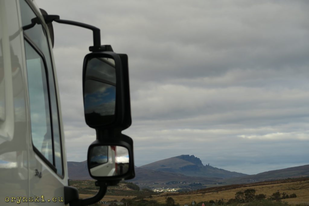
We might be on an island, but the wievs are mountainous. Bendy road without too many potholes, either climbs up with many serpentines, or gently touches the waterline. When Old Man of Storr becomes visible, it is the sign, that we have almost reached Portree, last bigger town on our route. Bigger as for local conditions, that is, as it is inhabited by less than 2500 people.
In Portree we turn left again. From here on a slightly different atmosphere can be felt. Suddenly one feels as if there was much more space around, and soon we can see Outer Hebrides on the horizon for the first time. Not long after the road descents down to the big bay, into which cuts a long concrete pier. This is a ferry terminal in Uig.
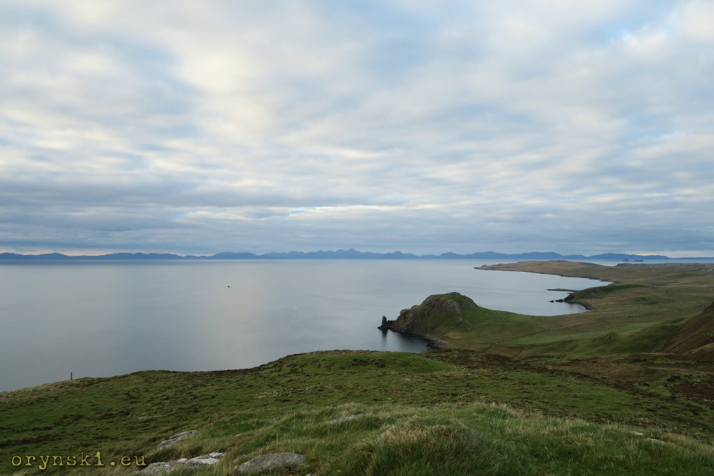
To our surpise the port is unusually busy. Apart from us and a cattle feed lorry, there are two tankers parked side by side. When collecting our tickets, we are informed that today’s sailing will be delayed by more than 90 minutes. In that case what else to do, but to climb the rocky hill dominating the landscape? From there we can see beautifully the whole archipelago of Outer Hebrides.
Incidentally, incomming ferry is also perfectly visible. That causes an instant retreat and we reach the ferry terminal almost simultanously with the vessel. But it turns that our stunt of running down the rocky path was completely unnecessary – for those two two tankers Uig ferry is a final destination, as they deliver fuel for the vessel. Filling up takes almost an hour, and finally the vessel goes to the sea with a 90 minutes delay, as predicted by the ferry terminal employees.
For Polish drivers, used to big ferries crossing Baltic Sea or La Manche, MV Hebrides or it’s sister vessels might seem to be a small bathtub. But there is enough space to fit small cafe and restaurant, it is also much easier to find a comfortable place to sit even during tourist season, and it is unlikely that anyone will have to queue for the shower. The whole crossing takes just under two hours, it is just enough to refresh and have dinner in onboard restaurant, as at this time of night there is no chance for hot meal in Lochmaddy.
Entering the port of Lochmaddy is a tricky task – it requires skillfull navigation between rocks while the hills only partially shelter the vessel from strong winds in the area. It is just enough to mention that MV Hebrides, that ususally covers that route, hasn’t been fixed yet after it’s recent misfortune, in result of each it has hit the rocky bank of the bay. This time, after few violent maneuveres, we are docked safely and as a first vehicle we leave the vessel through it’s prow gate.
Because of the delay it’s well over 21:00 hrs and there is nothing else to do but stop for the night. Unfortunately truck parking bays in Lochmaddy are occupied, so we have to look for a different location, which won’t be easy if we want to enjoy such luxury as mobile phone coverage. On the junction after the village we take the more northern one, which turns out to be not the best choise. On this single track there is no place to park, and since the roads leads through boggy area, leaving the tarmac is no option. Finally we reach another village from where a tiny road branches to the right, singposted for a parking and picnic place. Mobile signal is strong enough for our phone to display two bars – seems that it might be just the place we are looking for.
But on the islands nothing is so obvious. Couple of hundred metres down the road so narrow, that edges of the truck tires are already outside the taarmac, we arrive to this well advertised parking, which turns out to be a 10×10 metres square surrounded by the dry wall. There is no way we are going to squeeze a truck into it, and no chance to turn on the tarmac as it simply ends here. Luckily thanks to extra bar of lights we can disperse the dark…
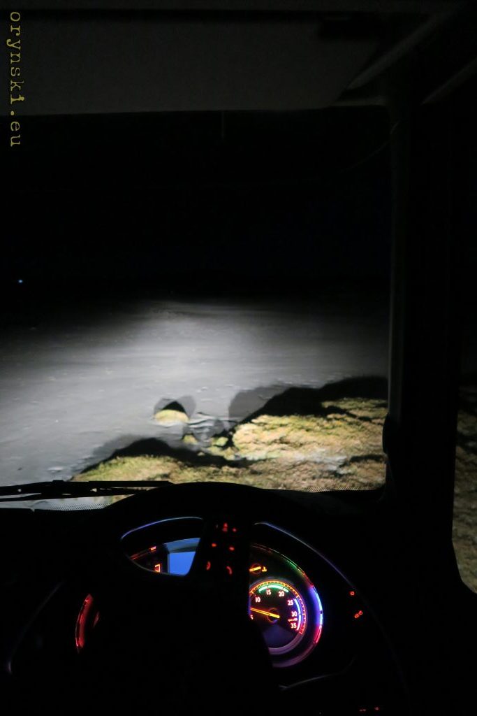
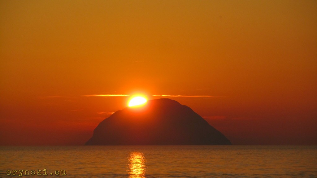
Things are good. Ahead of us there is a wide beach, and it seems water is at low tide. And because, unlike the land, sand tend to be hard enough to support even heavy vehicles (on Barra the beach even doubles as an airport runway!), we can drive on it without any fears. Therefore we use the beach to make a wide u-turn, and since it would be a shame to pay only a night visit to the location, that can be so beautiful during the day, we decide to stay here for the night. Our lorry is safely parked as close to the tarmac as possible (as we don’t know how high water comes during high tide) and we go to the bed, hoping that the morning will welcome us with breathtaking view. And it did – but this part of the story is for another time.
CLICK HERE TO READ THIRD PART OF THIS REPORTAGE
Below you can see the route covered today:
This piece was originally published in Polish at 40ton.net
[…] And what is my role in all of that? Hebrides Haulage was the first company in which I had a proper job after my arrival to Scotland. For two days every week I was driving around Glasgow, then I was leaving for Uists and Benbecula for the remainder of the week. Hungry for the new adventures I moved forward and for nearly 10 years I was doing pretty everything: I was going to London city centre, I saw most of Europe from behind the wheel of a small van, I graduated from Scottish university, helped to run a Polish internet portal, served as interpreter for Strahtclyde Police and tried myself in a role of the corpo-worker in the IT company. This last job convinced me, that I have not been created to spend my life behind the desk, clicking some numbers in Excel, especially that it was draining me with all my time and energy and I had no time for my writing. So when I saw the advert in which Hebrides Haulage was looking for part time driver, it was no brainer. Today I realise myself as a freelance journalist, and from Wednesday to Friday I climb behind the wheel of the orange lorry. Sometimes I am lucky to be sent to some beautiful places – from time to time I even have a chance to cover my old route to Uists and Benbecula. And where I cruise through the spectacular views of Scottish Highlands, passing tourists cars parked in the most attractive photo-spots, I think to myself making a living by going to the places where other people are willing to pay hefty money to reach can be one of the best jobs under the sun. More on that – in the next chapter of this reportage. […]
[…] the Scottish Western Isles. After being introduced to the company profile and everyday operations, we have accompanied a driver on his journey from Glasgow to port of Uig on the top of Isle of Skye, from where he took a ferry to Lochmaddy on North Uist. We left him when […]