Kintyre, located in the West of Scotland, it’s not an obvious destination for tourists. This dong-shaped peninsula is also not a convienient point to plan visiting it en-route to somewhere else. From the last major junction in Lochgilphead, there is still over an hour drive to Cambpeltown, Kintyre’s major town. 3,5 hour journey from Glasgow, although very pleasant on its own, requires that at least overnight stay if someone wants something more than just brief glimpse of the area. And there is a lot to be seen and explored. But the location far off the major routes might only be an advantage for someone that likes it peaceful and quiet.
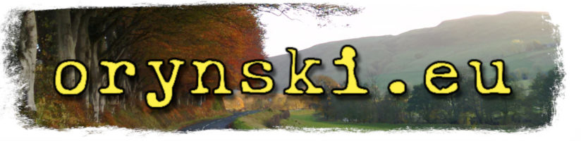
Although on the map the peninsula seems to be starting at the top of Loch Fyne where Lochgiplhead is located, on the closer examination the long loch cutting into it from South-West in about 1/4 from the top can be seen. On this narrowest point, a little town is located at the smallest bay on the opposite side. It’s Tarbert – one of many Scottish places bearing this name, which is gaelic for isthmus. And this isthmus that separates Knapdale, located at the northern bit of the peninsula, from Kintyre.
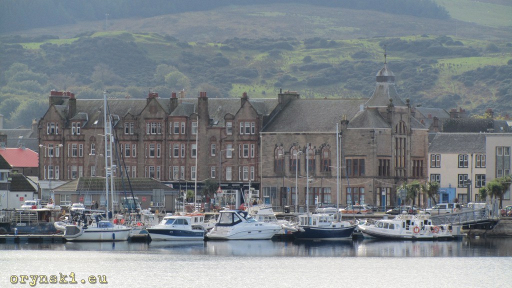
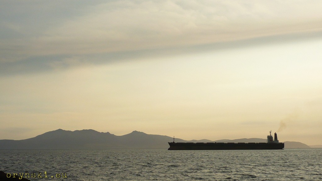
Small, but picturesque, Tarbert turns out to be relatively busy place, where local rhythm of life is dictated by the timetables of ferries, leaving in all directions from here. In the town itself a little terminal is located from which vessels to Portavadie on Cowal leave. From West Loch Tarbert – the long loch mentioned above – one can begin his journey to Islay or Jura. The little slipway across the land from there is where ferries from Lochranza on Arran land. Apart from that main road from Glasgow to Campbeltown goes through Tarbert, but don’t worry – it does not mean that the town is terrorized by hordes of noisy 44 ton trucks.
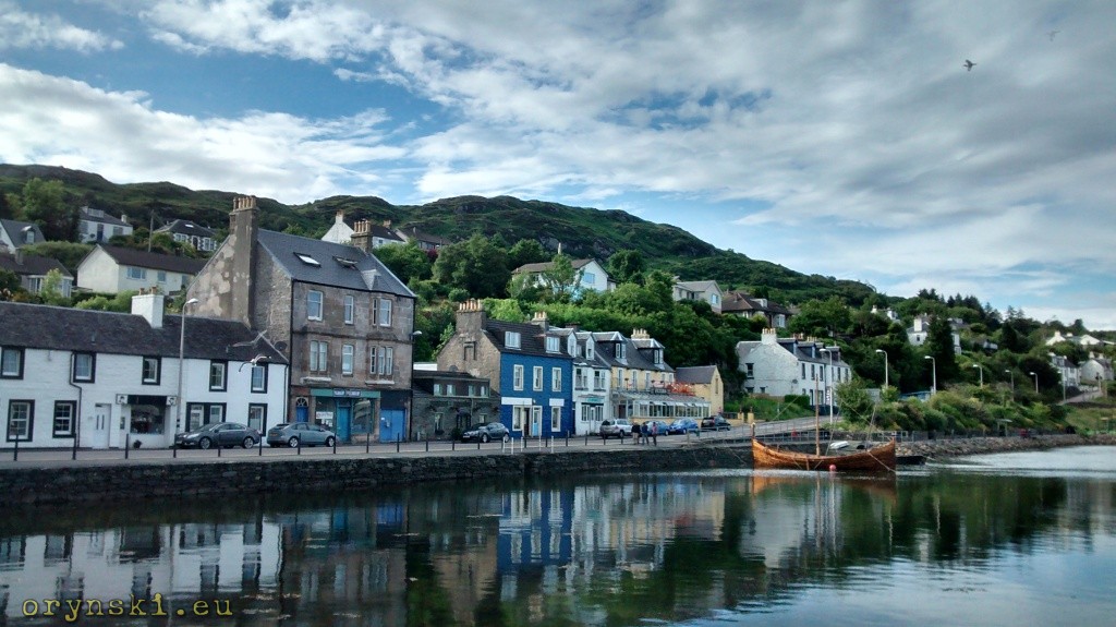
But Tarbert is not only a thorugh point. According to oldest chronicles it’s strategic position was defended by a fortified fort as early as 8th century. After all, it was also a through point on the easiest way from Ireland to Scotland. Local geographical circumstances allowed also Norwegian king Magnus Barfod to claim Kintyre by using a loophole: Scottish king Edgar agreed that Norwegians can take all the Western Isles that cannot be circumnavigated around by boat. Magnus pulled his boat across the land through the isthmus, and claimed that Kintyre is an island as well. Obviously he was the progenitor of the contemporary legal trolls…
Another smart-ass, who deciced to sail over the land – this time to gain some advantage in the battle – was Robert the Bruce himself. It was in 14th century and he even build a kind of conveyor of the wood logs to make the process easier. It allowed him to surprise Lords of the Isles who were, at this time, English allies. Aware of the importance of this location, the Scottish King ordered reinforcement and improvement of the existing castle. The bookkeeping records are one of the oldest Scottish documents. We can learn not only that joiner was paid 2.5 pence per day and smith 1.5 pence more, but also that Robert the Bruce paid extra five pounds, six shillings and eight pence on the top of the original quote because the walls were build thicker than it was agreed upon. Today’s lawyers would propably instead argue that this is a breach of contract and therefore no payment should be made. But maybe the fact, that the walls still stand on the hill above the town proves, that those money were well spend. I guess we should learn some lesson from it.
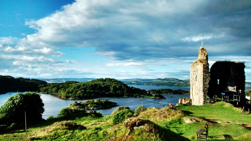
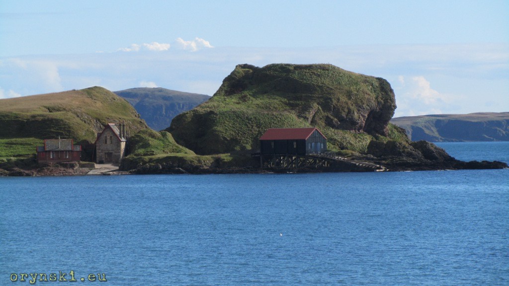
Those, for whom even Tarbert is too crowdy and too noisy (it can happen especially in July, when Seafood Festival takes place here), can go for a short stroll. The narrow path, leaving at the end of Garvel Road (on the opposite side of the bay than the castle) will lead along the water, then with the wooden gangway across the burn and over the mossy bog to finally reach a quiet pebbly beach. This small bay that is hidden from the town, yet makes a perfect spot to watch marine traffic entering and leaving Tarbert, including Cowal ferry.
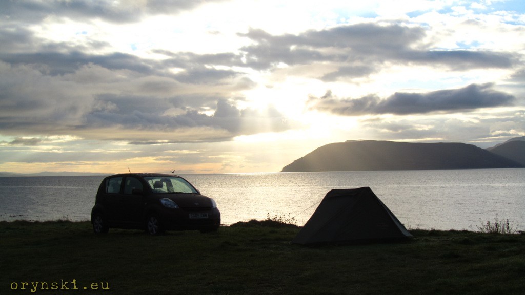
But Tarbert, while being a beautiful place, is only a gateway to all attractions of Kintyre. It should not be too hard to find them all, as the road network on the peninsula is very scarce: one route follows easter coast, the only other runs parallel to it along the sea on the west. The choice has to be made soon after passing ferry terminal for Jura and Islay: here a single carriage road crosses the land and leads to the Arran ferry slipway. From here, before turning south, it’s worth to take a small detour and visit Skipness. Apart from small village church, one can visit here a mighty castle and ruins of the Abbey from 13th century. Patches of grass along the road are popular (but not crowded) places to park a camper or place a tent. The proximity of the public toilets located at the ferry slipway is a big convenience and astonishing panorama of the less known side of Arran and glow of distant Glasgow visible at night provide unforgettable visual impressions.
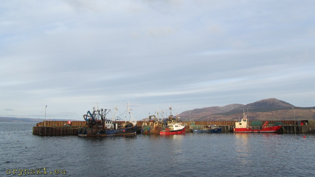
The road south from here leads along the coast of Kilbrannan Sound, crossing several deep valleys. Numerous steep hills make the journey a big challenge for cyclists, but their toil will be rewarded with a long downhill ride when the road, after climbing yet another hill, leaves the sea shore and takes the traveler into bigger valley that goes parallel to the coast. Here, the unique microclimate results in luxuriant flora and succulent colours of the fields below. At the end of the valley, an enchanting village of Carradale is located and the steep road goes down to the little port, that is still busy with fisherman boats. From here it is also worth to take as stroll to the nearby hamlet called Port Righ Bay, made up of few houses and a little hotel located at the little sheltered bay with a beach.
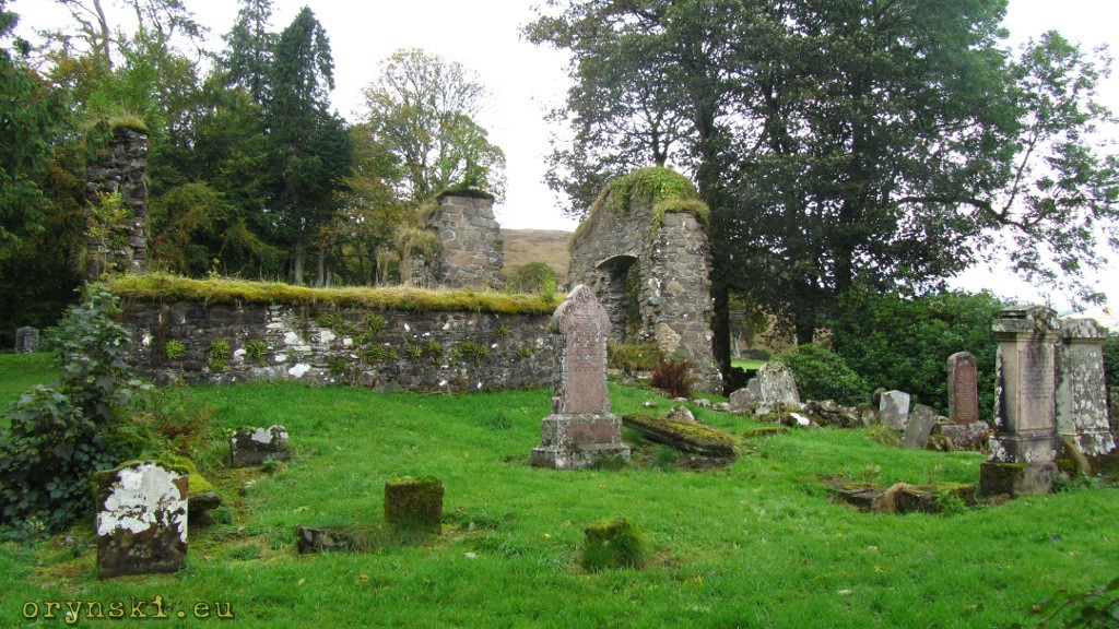
Going further south, the traveler will see opening of the Firth of Clyde. But before living Carradale area for good, it is worth to pop in to yet another hamlet at the mouth of Carradale Water, called Waterfoot. The next mandatory stop on our journey is Saddel, where apart from Saddel Castle (not open for visitors), one can find ruins of the Cistercian Abbey that was build here in 1207. At the adjoining cemetery a little shelter hosts exhibition of the ancient sculptured gravestones, that are among the best preserved ones in the area.
From Saddel it is not to far to the biggest town of the peninsula. But before panorama of Campbeltown opens to our eyes, Daavar island will dominate the view on the left. On the island the one of the Stevenson’s Lighthouse can be seen. In one of Daavar’s caves the painting of the crucifiction of Jesus was painted in late XIX century by the local artist Archibald Mackinnon. Since he worked in secret, the belief spread among local people that the painting is of miraculous origin, and when they found out that it was Mackinnon who painted it, he had to fled the town to avoid the anger of the disappointed. Luckily for him, they get to terms with the fact and he even returned twice to renovate the painting. His work is continued by his successor and the painting can be seen without need of hiring the boat, as it is possible to cross to Daavar on foot during low tide.
Campbelltown itself is quiet for a town of it’s size. One can feel, that it’s golden years are matter of the past, but Campbeltown is in no way dilapidated city. Walking on it’s empty streets it’s hard to imagine, how it could look a century ago, when ships in the port were loaded with the coal transported to the port on the narrow gauge railway. Thirty distilleries were scattered around the town and Campbeltown claimed to be a “world capital of Whisky”. Interesting reminder of this golden age is “Wee Picture House”, an oldest purpose build cinema in Scotland build in 1913 in Art Noveau style. The cinema is located close to the local museum.
The whisky industry fell victim of it’s own success, as in answer to a huge demand for the local beverage producers focused on quantity rather on quality. The Great Depression and introduction of the prohibition in the US drastically reduced demand and the local product lost with whisky distilled in other parts of Scotland, resulting in bankruptcy of the vast majority of local distilleries. At the same time importance of the coastal ships decreased after majority of the transport needs became fulfilled by the road haulage. Suddenly Campbeltown from the major hub on the western coast turned into a little town off the major routes. Regular attemps to bring visitors and business to the area by opening ferry routes (such as car ferry to Northern Ireland that was operating in late 1990 or extension of the Ardrossan – Brodick ferry route in the summer of 2014) so far has not proven to be economically viable. Local needs are met by the small vessel owned by Kintyre Express, offering a regular ferry service for pedestrian and cycles to Ballycastle in Northern Ireland. If that’s not enough, another ferry can take the traveler from Ballycastle to Rathlin Island, famous for it’s colonies of the sea birds.
But even if someone chooses to stay in Scotland it is still possible to see Ireland. For that it’s enough to go south (either continuing along the coast, or using main road B842) to Southend, located at the southern coast of Kintyre. Here it is easier to see that the times of former glory are long time gone, but dusty windows of the empty shop or abandoned hotel, that could play a major role in a horror movie, are not the only attractions. Next to the sandy beach with a beautiful panorama of Ireland, protrudes mighty Dunaverty Rock, under which a small boat houses are build. But long time ago, a castle capable to give shelter to three hundred people was located on that rock. It was a place of the infamous Massacre of Dunaverty of 1647, when protestants slaughtered a couple of hundreds of Catholics, among them a numerous family of McDougalls.
No wonder, that Christians prefer to remember the events that happened on the opposite end of the beach. Here is the spot on which St Columba landed when he first time arrived to Scotland. His footsteps can be seen imprinted in the rock, suggesting that despite popular misconceptions about poor nutrition, at least some people in the middle ages were fat.
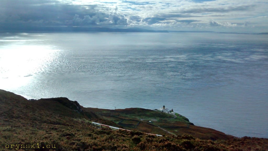
The name Southend suggest that you can’t go any further. But it is not only possible, but well worth it. You just have to turn West and after less than 30 minutes drive, you’ll arrive to one of the most beautiful spots in Scotland – Mull of Kintyre lighthouse. Since the lighthouse was constructed at the sea cliff, it was impossible to get access from the water, therefore all materials had to be transported on the horseback. Difficult terrain meant that it was possible to make only one such journey per day, and extreme weather conditions at the storm-battered tip of the peninsula meant that the work could be carried only during the summer. Despite all those difficulties, the construction was completed in two years. And even despite today the Lighthouse is connected with the civilization with a tarmac road (although it’s last bit is closed to unauthorized traffic due to it’s unusual steepness), it’s easy to imagine how hard the life of the Lighthouse keepers had to be. Especially that when they were taking care of their household duties, or were working in one of the walled gardens, they could see Ireland just few miles across the water… Today the lighthouse is fully automatic and the only permanent residents are sheep grazing in the heather. And this is really the furthest point of Kintyre.
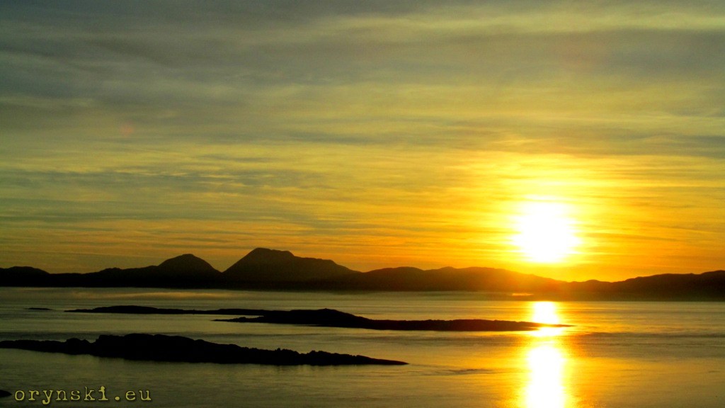
Those, who don’t like to retract their steps can choose to get back to Tarbert along western coast. This side of the peninsula is very different. Mainly flat road leads along the sandy beaches and while on the right one can see some gently rolling hills, the panorama of Jura and Islay on the left draws much more attention. Roughly mid-way between Campbeltown and Tarbert a short ferry journey across the water from Tayinloan lies Gigha. This small island, owned by the local community, is famous for it’s sandy beaches, rich history and numerous shipwrecks.
But there is one more place worth visiting before turning back north. Machrihanish, located across the peninsula from Campbeltown, is famous for it’s link golf course with the “most beautiful opening hole in the world”. Today this golf course, along with amazing sunsets and sandy dunes, make the town’s major attraction and not much more is going on here. But for centuries coal was mined in the area. Most of it was used in local distilleries, but some of it was transported to Campbeltown – first on the horseback, then on the purpose build canal that then in turn gave place to a narrow gauge railway mentioned before. Hundreds of years ago the little railway cars carried also hundreds of tourists, but those times are long gone: last train ran in early 1930’s and three decades ago last mine was closed. Still, the town was a noisy place, as during cold war RAF base and US Marines occupied the mighty airport located there. Exceptionally long runway was a designated backup landing strip for space shuttles.
But the strategic location of Machrihanish was observed well before the Cold War. It’s here, where Canadian Reginald Aubrey Fessenden, a pioneer of radio communication, build his 120 m tall mast, used to carry first successful two-way radio transmission across the Atlantic. But today, it’s quiet and peaceful, which is likely to make birdwatchers visiting local Seabird Watching Station very happy.
And this is probably the major advantage of this part of Scotland. Peaceful, quiet, and close to nature, yet still proving that it is a place of rich history.

As it is a long way to get to Kintyre, you should plan at least two days to see it.
[…] the ways of life on the islands, but it has also side-tracked some important marine towns such as Campbelltown. The size of the vessels, along with the improvement in road network, make also canals redundant, […]